Pamban Bridge and the road to Dhanushkodi
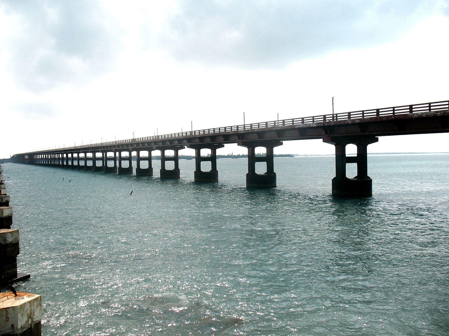
Two bridges carry road and rail across the sea to Pamban Island, and a road runs on to the ruins of a town wiped out by a cyclone in 1964, ending on a strip of sand pointing at Sri Lanka.
i
Sugeesh at Malayalam Wikipedia · CC BY-SA 3.0The approach to Rameswaram is one of the great journeys in South India. The mainland ends at Mandapam, and beyond it lies a narrow channel of sea, the Pamban strait. Bridges carry the road and the railway across to Pamban Island, where Rameswaram stands. At the island's far eastern end, a road runs out along a narrowing spit of sand to the ruins of Dhanushkodi, a town destroyed in a single night in 1964, and on to a point where land simply stops, facing Sri Lanka across shallow water.
The Pamban bridges
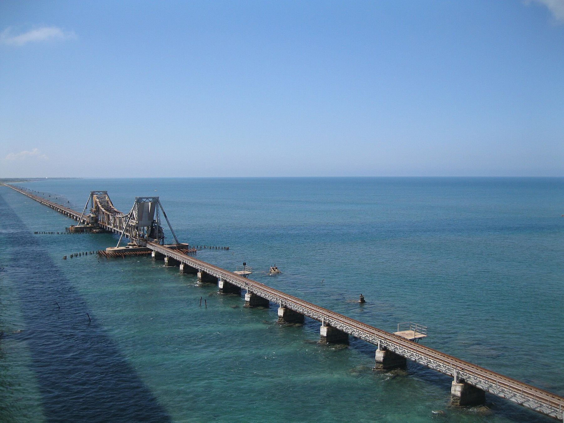
For most of the twentieth century, the only link was a railway bridge opened in 1914, with a section that lifted to let ships pass. It became one of India's best-known railway journeys, with the train rolling just above the waves. In 1988 a road bridge, roughly two kilometres long, was opened alongside it, giving the island a road link for the first time. In recent years a new railway bridge with a vertical-lift span has been built to replace the old one, which had served for more than a century.
From the road bridge, you look down on fishing boats, the line of the railway beside you and the turquoise and green bands of shallow water. There are viewpoints at either end where people stop, but stopping on the bridge itself can be restricted; follow local signs and traffic.
i
Shubham Gupta · CC BY-SA 3.0Rameswaram town
Rameswaram is a small pilgrim town built around its great temple. Fishing is the other mainstay, and the harbour is full of brightly painted boats. Many visitors stay only for the temple and its rituals, but the island deserves a little more time: the drive to its eastern tip is one of the most striking short trips in the state.
Dhanushkodi, the town the sea took
Before 1964, Dhanushkodi was a busy small town at the end of the railway line, with a station, a church, a post office and a ferry pier for boats to Sri Lanka. In December 1964 a severe cyclone struck the area. A storm surge swept over the low spit, destroying the town and a train that was approaching it, with great loss of life. Dhanushkodi was never rebuilt.
Today the ruins stand on bare sand between two seas: the shell of a church, walls of the railway station and the water tank, and scattered remains of houses. Fishing families live nearby in simple homes, and small stalls serve visitors. It is a sobering place, and a beautiful one, with the calmer water of the Palk Bay on one side and the rougher Gulf of Mannar on the other.
Arichal Munai and the end of the land
Storey VI · RameswaramThe corridors at dawn: Ramanathaswamy, RameswaramA road now runs beyond Dhanushkodi to Arichal Munai, the very tip of the spit, where a monument marks the end of the road. From here a chain of sandbanks and shoals, known as Adam's Bridge or Rama Setu, stretches toward Mannar Island in Sri Lanka, a few tens of kilometres away. Tradition links this line of shoals to the bridge built by Rama's army in the Ramayana. Whatever your view, standing at the end of India with the sea on three sides stays with you long after you leave.
Notes from the gate
- The road to Dhanushkodi and Arichal Munai is generally open in daylight hours. Access can be restricted at night or in bad weather; check locally before you set out.
- There is little shade, and the wind can be strong. Bring water, a hat and sun protection.
- The sea near the tip can have strong currents. Swimming is dangerous, and in places it is prohibited.
- Do not drive on the sand off the road; vehicles get stuck easily.
- Fuel and services thin out east of Rameswaram town.
On the way: a memorial
On the island, a memorial honours Dr A. P. J. Abdul Kalam, the scientist and former President of India, who was born in Rameswaram. It is a popular stop with Indian visitors, and a reminder that the island has given the country more than its pilgrim fame.
The two seas
The spit beyond Rameswaram divides two very different bodies of water. To the north lies the Palk Bay, usually shallow and calm, often milky green. To the south is the Gulf of Mannar, open to the ocean swell, darker blue and more restless. Standing in the middle of the sand, you can see both at once. The Gulf of Mannar is home to coral reefs and a marine national park, protected for its reefs, seagrass and the rare dugong. Collecting shells, coral or anything living from the shore is not allowed.
Birds gather on the flats and lagoons along the road, especially in the cooler months, when migrants arrive from the north. Flamingos and other wading birds are sometimes seen in the shallows.
When the town is kindest
November to February is the most comfortable time. The northeast monsoon, usually from October to December, can bring heavy rain and occasional cyclone warnings; the road to the tip may close. Summer is very hot. Start early in the morning for the softest light on the water and the fewest people at the ruins.
Pair the trip with a dawn visit to the temple: see the corridors at dawn. For getting here from Madurai, read linking the six towns, and for the festival dates that fill the island, a year of temple festivals.